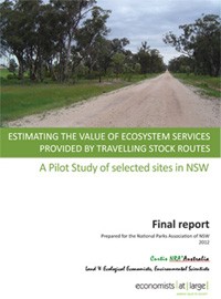
The Travelling Stock Routes and Reserves (TSRs) comprise a vast network in New South Wales and Queensland of public land (some 3 million hectares), bordering roads and creeks and other private and public land, formerly used for intermittent grazing and to drive stock to market. Today they are largely an anachronism. Extra fodder is often purchased and graziers mostly use road transport to take animals to market. Nevertheless, they are often used by local graziers to rest stock and access is allowed to the public, who often camp alongside creeks and roads. They are acknowledged as a valuable conservation resource, often being the only intact native vegetation in a mosaic of cultivated and modified land.
The TSRs in NSW cover an area of approximately 700,000ha and are administered by the Livestock Health and Pest Authority (LHPA). The Rural Land Protection Board (RLPB) administered the TSRs until 2009.
The remnant vegetation within the TSR network is a significant national biodiversity asset but faces possible conversion due to grazing, logging, mining exploration and privatisation. The NSW Government has restructured the TSR management system with an emphasis on economic benefits of TSRs.
This report looks specifically at the economic value of the ecosystem services provided by TSRs, as a proxy for their economic benefit to society. Table 1 in Section 5 of this report provides a tabular summary of the different types of ecosystem services. Two TSR sites in NSW were selected for this pilot study. The study is intended to assess the feasibility of putting a value on the ecosystem services provided by two TSRs with a view to conducting a larger study into the value of the entire TSR network in NSW.
The Travelling Stock Routes (TSRs) used in this pilot study are Borah Creek (261ha) and Saveall Creek(64ha), two larger TSR sites near Tamworth, north-east New South Wales. These sites were selected from a conservation assessment of reserves and TSRs in the Tamworth region.
The methodology to estimate ecosystem service values used in this study was developed by Dr Ian Curtis during his Doctor of Philosophy degree at James Cook University between the years 2000 to 2003. The methodology uses an opportunity cost approach to valuing ecosystem services. Dr Curtis’s methodology is based on Land Economics theory and practice, utilising the current median unimproved land value in a bioregion to set a base value for land that is not traded, such as a National Park, or a TSR. A very simple summary of the methodology is provided in the diagram below:
The TSRs selected for this pilot study were both located near to each other in the New England Bioregion. The median unimproved value per hectare of the alienated (rateable) land in the bioregion was used as a surrogate for the median unimproved capital value per hectare of the un-alienated (public or unrateable land). Adoption of the median unimproved capital value results in a conservative estimate, allowing that other uses of land can co-exist with the provision of ecosystems services.
The mean of this data set is $1,924.43 per ha, and the median is $1,870.30 per ha. However, the ‘per’ hectare value to be used in this study is only the median ($1,870 per ha).
Capitalisation rates for this ‘land use characteristic’ would normally be 7 – 8 %, while for this ‘level of protection’ they would be, say 9%. The higher capitalisation rate of 9% was thus used.
Applying the capitalisation rate to the median capital value, results in an annual value $168.30 per hectare of ecological values, or the production function of the land in its natural state.
Because Borah Creek is a large parcel and majority hillside remnant, adjoining other like vegetation, rather than roadside, the impact of edge effects is likely to be only 5 per cent of the overall value.
Conversely, Saveall Creek is a linear corridor between the road and the creek, such as does exist often for TSRs in NSW. Edge effects are likely to be significant, and on both sides of the lineal corridor. In the case of this parcel edge effects are likely to be up to 50% of the overall value. This is a conservative estimate, as edge effects can extend up to 200 metres (decreasing) into a forest from an edge.
Using the median of the unimproved capital values, accounting for the status of the forest and edge effects, the dollar values of the ecosystem goods and services provided by these parcels of land are given in the table below.
| Parcel | Area (Ha) | Per Ha Per Annum | Total | StatusOpen ForestFig D16contribution at 67% | Edge Effects | Total Value per Annum after edge effects |
| Borah Creek |
261 |
$168 |
$44,555 |
$29,852 |
5% |
$28,359 |
| Saveall Creek |
60 |
$168 |
$10,288 |
$6,893 |
50% |
$3,446 |
These two areas represent just 321ha of a total of approximately 700,000ha of TSRs in New South Wales. To value the ecosystem services for these areas of public land at zero is clearly inappropriate. Despite this, putting a value on the entire network would take a considerable amount of work.
In order to put a value on the entire TSR network in New South Wales, site-specific ecological surveys would be required. These surveys would need to record the total area of the TSR, the vegetation type, density, adjoining land use and likely edge effects. Improved mapping would also be useful. These are not insurmountable barriers and this pilot study has shown that the ecosystem service values of TSRs to the public can be quantified. These values should be considered in ongoing discussion about the tenure and management of TSRs.


